 Image 1 of 1
-
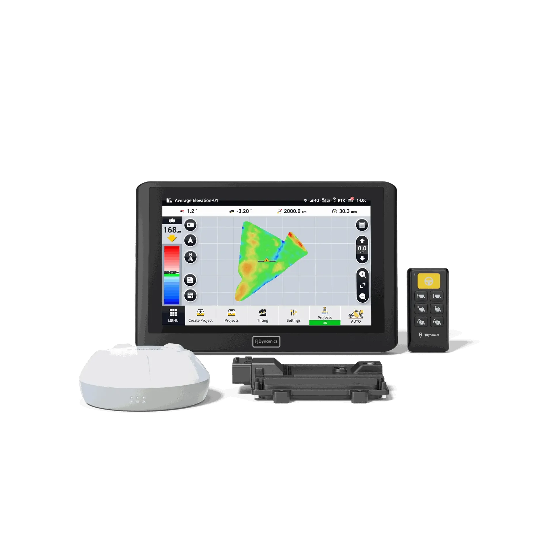
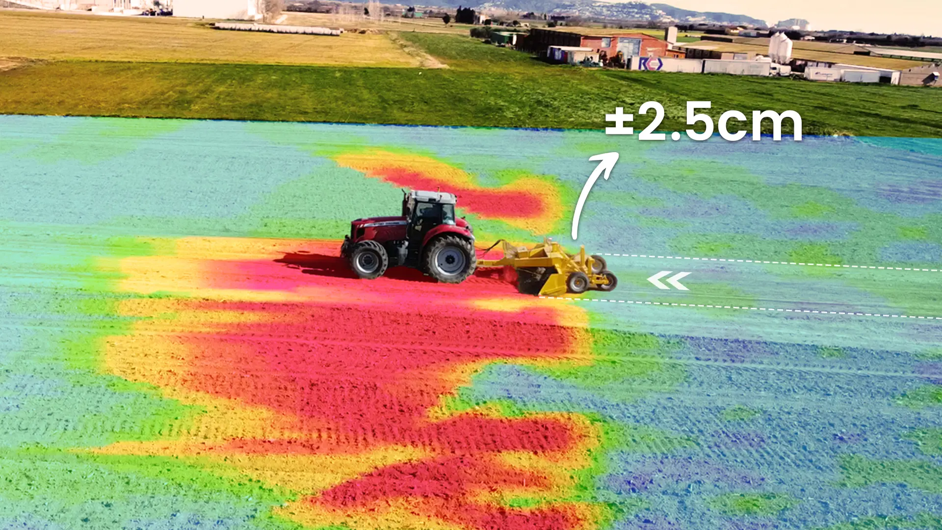
GNSS-Based Auto Leveling
RTK-precision blade control for stable, accurate grading across large areas.
-
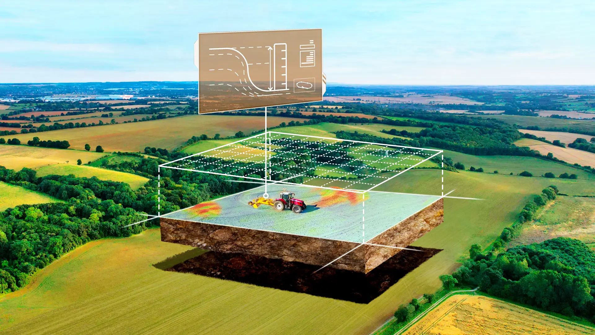
Terrain Survey & Design
Map elevations, generate cut/fill plans and design level, single-slope or dual-slope surfaces.
-
File Import / Export
Share projects between machines; import third-party design files to start leveling fast.
-
Record Keeping
Save projects and export PDF reports for analysis and compliance.
-
Multi-Machine Collaboration
Transfer project files so multiple tractors can work together efficiently.
-
Remote Support & OTA
Over-the-air updates and remote assistance to reduce downtime.


Specifications
- Control Terminal
- 10.1" LED backlight
- Network
- 4G (compatible with 2G/3G)
- GNSS Bands
- GPS L1C/A, L1C, L2P(Y), L2C, L5; GLONASS L1/L2; Galileo E1/E5a/E5b; SBAS
- Radio (Terminal)
- 433/470 MHz
- Operating Temp
- −20 °C to 65 °C
- 4G Antenna Bands
- B1/B2/B3/B5/B8/B38/B39/B40/B41
- VCU Power
- 9–36 V, max total current 30 A
- VCU Size
- 184.1 × 148 × 34.4 mm
- Keypad
- IP67, ≥ 1,000,000 button presses
- Storage Temp
- −40 °C to 85 °C
Specs summarized from FJD’s AL02 brochure; capabilities may vary by kit and region.