 Image 1 of 1
-
GNSS-Based Leveling
RTK-precision blade control for centimeter-class grading and water management.
-
Terrain Survey
Collect boundaries and interior points to build accurate elevation maps for design.
-
Terrain Design & Analytics
Create level or sloped surfaces, view cut/fill & earth-moving estimates, and set flow direction.
-
File Transfer & Collaboration
Share projects between machines and keep work synced across teams.
-
Height Calibration
Benchmark and calibrate heights for consistent leveling accuracy.
-
Record Reserve
Completed jobs are saved for reuse and audit, reducing rework.


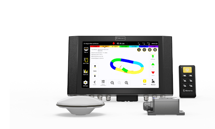
Specifications
- Control Terminal
- 300×190×43 mm; Android 5.1; 10.1" 1280×800 LED; IP65; 10–30 V; 4G (2G/3G compatible); Ports: Camera×2, Radio×1, 4G×1, GNSS×2, Image Tx×2
- Handheld Keypad
- 9–36 V; ≥1,000,000 clicks; IP67; −40 °C to 85 °C (operating/storage)
- GNSS Antenna
- 152×63 mm; GPS L1/L2, GLONASS L1/L2, BDS B1/B2/B3; IP67; −20 °C to 70 °C
- IMU
- 55×37×24 mm; static accuracy 0.3°; 5 V DC
- Radio Antenna
- 433/470 MHz; Max power 100 W; −20 °C to 65 °C
- 4G Antenna
- B1/B2/B3/B5/B8/B38/B39/B40/B41; Max power 100 W; −20 °C to 65 °C
Summarized from the official AL01 product & specs pages.